
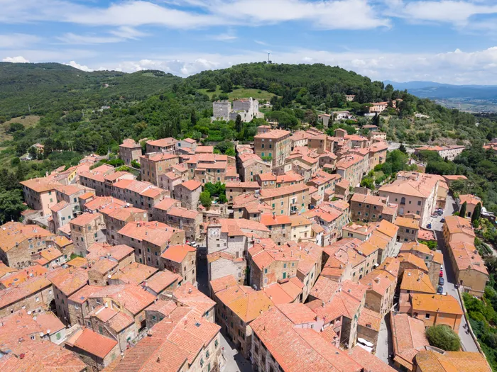
A medieval hilltop borough suspended between sea and hills, at the heart of the Etruscan Coast. Thermal springs, mining archaeology and one of Tuscany's most technical bike areas — this is where the Tuscany Trail calls home.
The map is centred on the Fiere di Venturina, where thousands of riders roll out for the Tuscany Trail every year. Everything you see is bookable — move the map to explore the rest of the territory.
Everything on the map is bookable.
A typical day: breakfast in the borough, the Rocca and historic centre, a local lunch, then the Thermal Baths or the Parco Archeominerario in the afternoon. Riders: Bike Area Monte Calvi and the trails through the Parco.

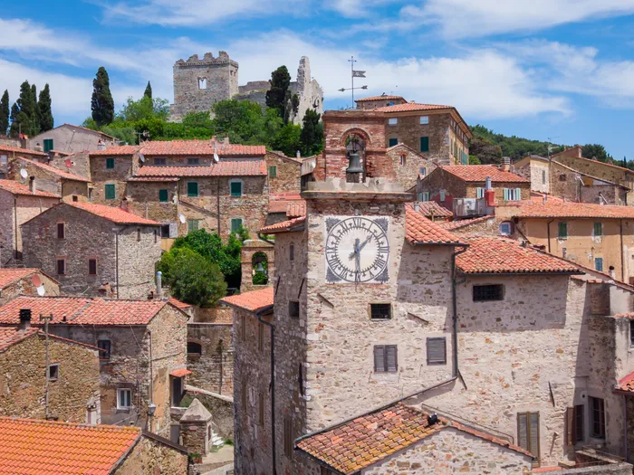
Piazza della Repubblica, narrow alleyways and hidden corners. Every August, Apritiborgo — an international theatre festival — turns the streets into an open-air stage.

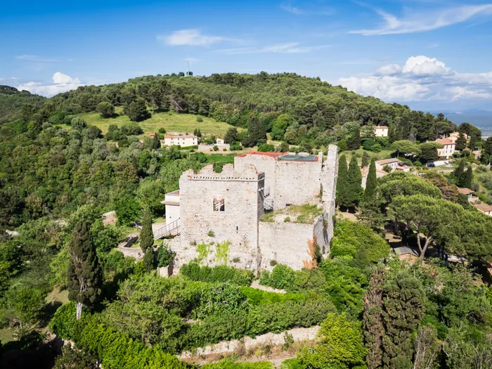
XII-century fortress commanding the valley, with panoramic views stretching all the way to the Tuscan Archipelago.

A XII-century Romanesque church in local stone, and the 14th-century Palazzo Pretorio with its row of podestà coats of arms carved into the facade.

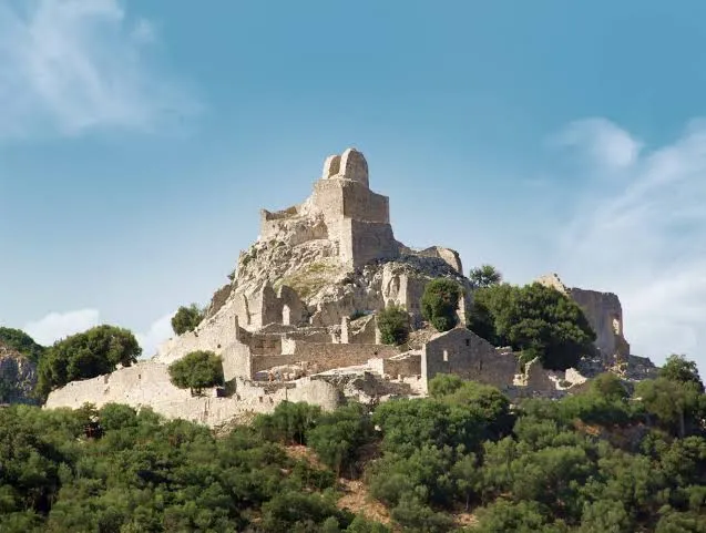
Copper, lead and silver mines, a medieval mining village and the Miner's Museum. Inside the park: a bike park with cross, enduro and downhill trails.

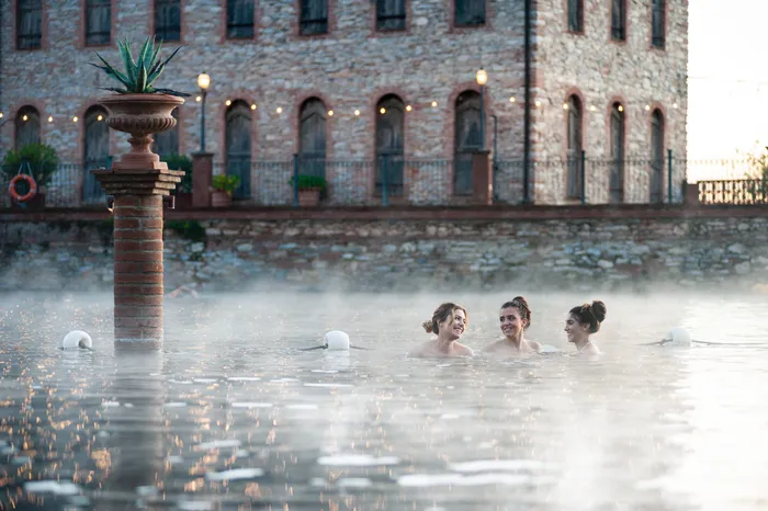
Natural thermal waters at 36°C and a Silence Area for meditation and nature — just minutes from the borough.

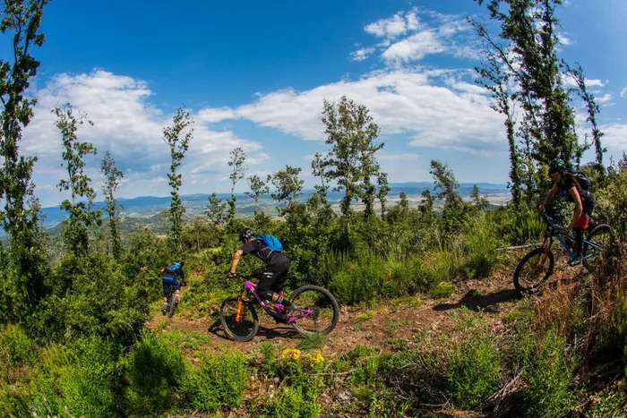
Fifty-four mountain bike trails on the slopes above the borough, from flowing berms to steep enduro singletrack, dug and maintained by the local riding association.
From the Tuscany Trail 365 Magazine.
Piazza della Repubblica, alleyways and hidden corners of one of the most striking towns on the Etruscan Coast.
The medieval fortress dominates the valley, with views stretching all the way to the Tuscan Archipelago.
Mines, museum and bike park: one of the strongest, most tangible stories in the area.
Terme del Calidario is the perfect complement to a day on the bike.
Editorial content from Tuscany Trail 365 magazine.
From the official Campiglia Marittima guide — the depth that makes this borough worth more than a photo stop.
The San Silvestro mines have yielded copper, lead and silver for over a millennium, feeding medieval Europe's hunger for metals. Today the Temperino tour takes you underground into a real mine, the restored miners' village shows daily life as it was, and two museums cover the archaeology and the machines.
The Calidario thermal springs flow naturally at 36 °C, known since Etruscan and Roman times. Around the open-air thermal lake you'll find massages, thermal muds and saunas — and near the Tufaia ponds, the Area del Silenzio, a garden designed for meditation and slowing down.
The 12th-century fortress was built to defend the borough from Saracen pirate raids along the Tyrrhenian coast. Its walls and towers still command the valley, with a panorama stretching to the Tuscan Archipelago that alone is worth the climb. Visits can be booked through the Parchi Val di Cornia.
Seat of local government since the 14th century, its austere facade is studded with the coats of arms of the Florentine podestà who ruled the borough between the 15th and 17th centuries. Today it hosts exhibitions and cultural events.
The practical layer — getting here, one perfect day, and who to call.
By car, leave the SS1 Aurelia at the Venturina Terme exit and follow the signs uphill to the borough. By train, Campiglia Marittima station sits on the Pisa–Rome line with connections from Pisa and Florence airports.
Breakfast outdoors in a bar of the borough, then the Rocca while the light is still low. Lunch among the alleys, an afternoon guided tour of the Temperino mine and the miners' village, and a sunset soak in the thermal lake to close the loop.
The Parco Archeominerario runs guided tours year-round, in several languages, with special events and workshops for groups and families. The tourist office in Via Cavour (0565 838470) helps with bookings and tailored itineraries.
From the restored Fonte Corboli washhouse, with the valley and the sea on the horizon, a food-and-wine trail links olive groves, vineyards and organic farms around the borough — the slow-day alternative when the bike rests.
Why Campiglia is the technical heart of the Tuscany Trail territory.
Run with passion by the Sdegnetors ASD, the trail network on Monte Calvi grades from flowing lines with shaped berms and small jumps up to black enduro singletrack that demands precision and courage — with views from the Archipelago to the inland hills the whole way.
The white roads and trails around the borough are the same ones ridden by thousands at the Tuscany Trail. The bike park, the mining park trails and the event route weave into one riding playground.
The mountain bike side of Campiglia — a different bike from the one this site usually talks about.
This is gravity terrain built by an enduro club, not a gravel network. The lines run from flowing berms to steep technical singletrack, and most of them ask for a full mountain bike. Trailforks does flag 22 of the trails as gravel-rideable and 50 as e-bike friendly, so a lighter setup is not shut out — but the heart of this place is mountain biking, and it rewards arriving with the right bike rather than the one you packed for the white roads.
The trailhead car park sits about 200 metres from Piazza della Repubblica, which makes this the rare trail area you reach on foot from the village. From there the network climbs the slopes of Monte Calvi, with the bulk of it around three and a half kilometres north of the borough and the highest trailhead at 634 metres.
Fifty-four mountain bike trails, 76 kilometres of them, and 4,146 metres of descent across the whole area. Grading follows the UK and European system — 8 white, 17 green, 11 blue, 6 red and a single black, plus 11 access roads to link them together. That spread is the character of the place, a network built for progression rather than for extremes.
ASD Sdegnetors MTB Clan, the local riding association, digs and maintains these trails. Trail conditions and closures are posted by them on the map below, so a look before you ride is worth the minute it takes. If the area gives you a good day, the club is who to thank.
The singletrack network on the slopes above the borough, mapped and kept current by the riders who build it. Move the map to explore, tap a line to read its grade and its condition.
Grades, conditions and closures come straight from the local riders, so this map stays truer than anything we could copy across. Open the full area on Trailforks →
The booking map at the top of this page shows every stay in the area — no need to leave the site.